
The Quaker City course map.
Course map (PDF, 2 pages). The race course, and launch and parking at the Temple boathouse.
Download PDF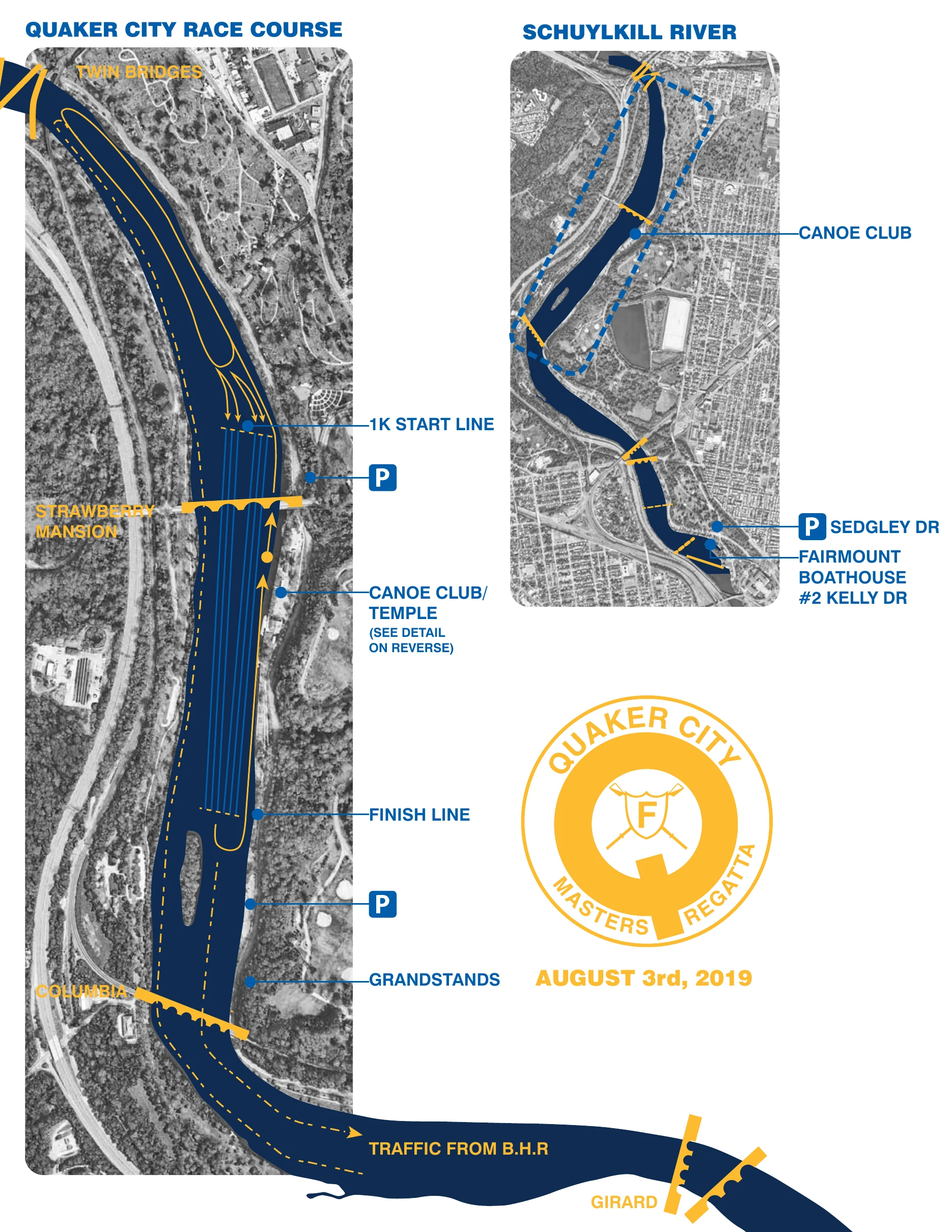
The Race Course
Start to finish.
From upriver to downriver, as shown on the map:
- 1Twin BridgesThe upriver end of the map.
- 21K start lineParking on the Kelly Drive side, just below the start.
- 3Strawberry Mansion BridgeThe course runs under the bridge.
- 4Canoe Club / TempleLaunch and registration (detail below).
- 5Finish lineParking on the Kelly Drive side, just below the finish.
- 6GrandstandsOn the Kelly Drive bank, below the finish.
- 7Columbia BridgeJust below the grandstands.
- 8Traffic from Boathouse RowCrews rowing up from Boathouse Row come from below Girard Avenue.
- 9Fairmount Boathouse, #2 Kelly DrParking on Sedgley Dr.
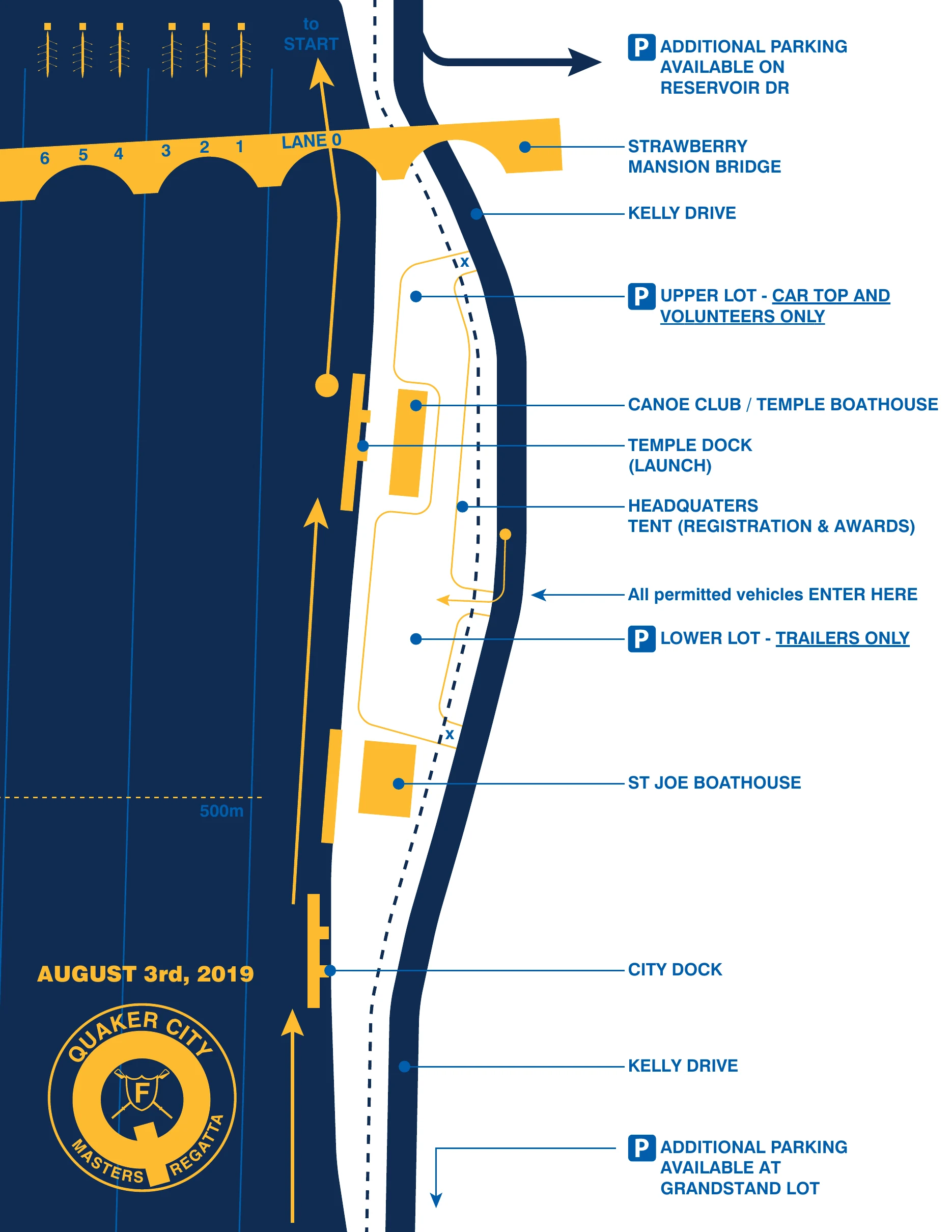
Launch & Parking
At the Temple boathouse.
From the bridge down Kelly Drive, as shown on the map:
- 1Strawberry Mansion BridgeLanes 0 to 6 pass under its arches; Lane 0 is nearest Kelly Drive.
- 2Additional parking on Reservoir DrOff Kelly Drive, above the bridge.
- 3Upper lotCar top and volunteers only.
- 4Canoe Club / Temple Boathouse
- 5Temple Dock (launch)Crews launch here and row up to the start.
- 6Headquarters tentRegistration and awards.
- 7Vehicle entranceAll permitted vehicles enter here, from Kelly Drive.
- 8Lower lotTrailers only.
- 9St. Joe's Boathouse
- 10500m mark
- 11City Dock
- 12Additional parking at the Grandstand lotDown Kelly Drive, at the grandstands.